
Construction sites · Properties · Hunting tracts
Aerial Mapping
Give owners, contractors, and hunting partners a shared reference for access, improvements, recorded features, and work planning.
Discuss a Mapping Project ↗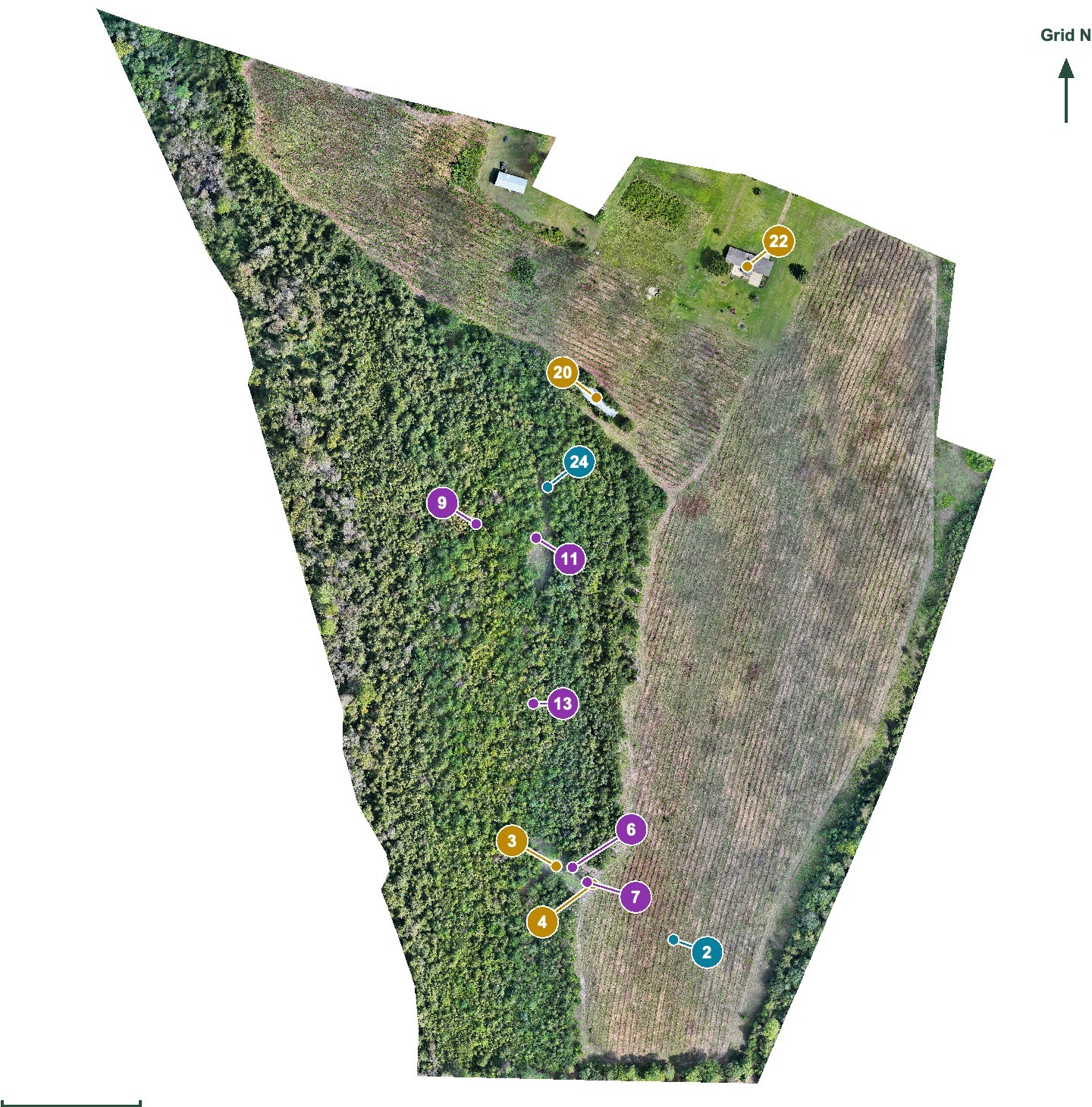 THE WHOLE TRACT
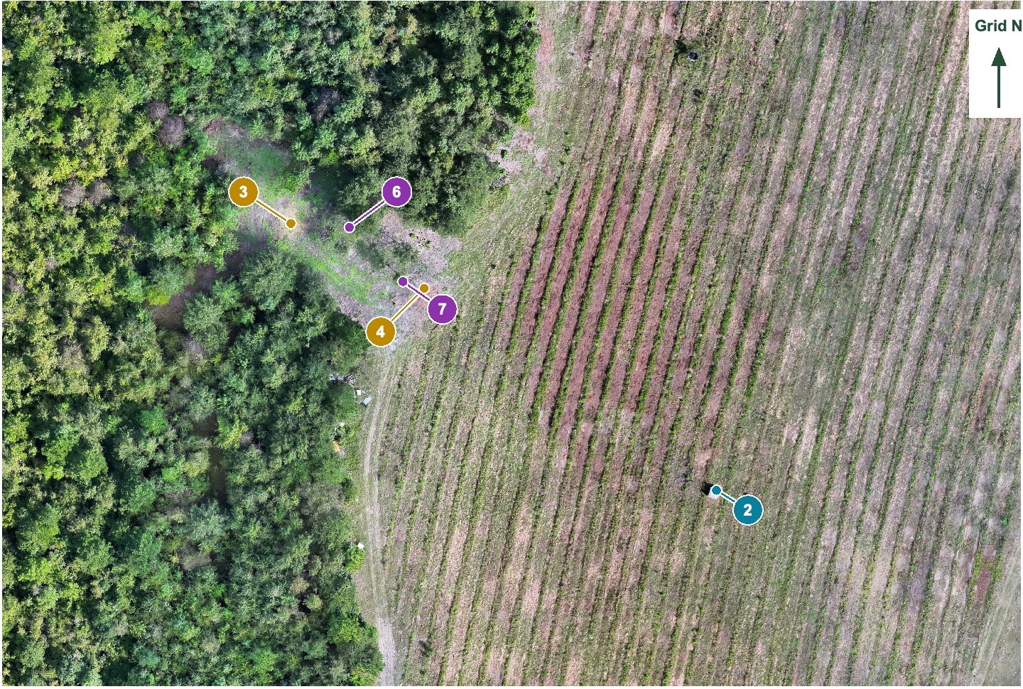 THE DETAILS THAT MATTER
Clemson drone coursework and DroneDeploy training support capture planned around the finished map.
Meet Donnan & explore his qualifications ↗The purpose
Connect the property. Plan the work.
Bring a construction site, commercial property, or land tract into one useful overhead view. Choose a stitched map, agreed measurements, annotations, or detail views around the work you need to plan. Hunting-property maps can include recorded food plots, access, blinds, cameras, feeders, and other owner-supplied features. We can also work with partner companies to produce full-scale laminated site maps showing true north and a scale at an additional cost. We’ll discuss the intended use, print dimensions, map coverage, and production needs with you as part of the project.
For: Builders, property owners and managers, landowners, hunting-property owners, and land-management contractors.
What you receive
Defined before you book
- Stitched overhead maps in JPG/PDF
- Agreed site, property, or hunting-tract annotations
- Measurements and selected detail views, as scoped
- Updated mapping for project stages or property changes
- Optional full-scale laminated site maps through partner companies, with true north and a scale; quoted separately
What you can use
A map you can put to work.
Receive a stitched JPG/PDF map with agreed labels and detail views. Use it to discuss access, food plots, improvements, or site work with your contractor or hunting partners. Updated maps can document changes at an agreed project stage.
Landscape · map · detail
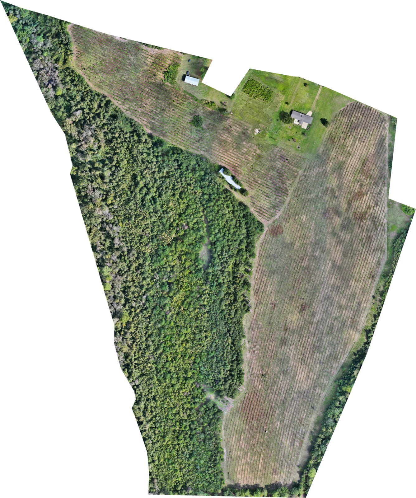
From landscape to a useful field map.

Landowners & land agents
Your tract.
A clearer plan.
A stitched map connects the property. Numbered reference points and close-up views help you discuss food plots, blinds, cameras, feeders, and access with a land contractor or hunting partner. Selected aerial photographs can also help present a tract listing.
A wooded aerial map shows the canopy; it does not reveal every ground feature beneath it. We’ll discuss useful coverage before quoting.
Three practical uses
- A visual reference for ownership and maintenance
- A shared map for planning with a land contractor
- Aerial photographs and an optional short video for a land listing
Our local service area
Lake Oconee · Greensboro · Eatonton · Madison · Lake Sinclair
Additional service in Watkinsville.Tell us about your mapping project.
Send the property location, your concern or project goal, and your preferred timing. We’ll confirm scope, deliverables, price, and scheduling before booking.