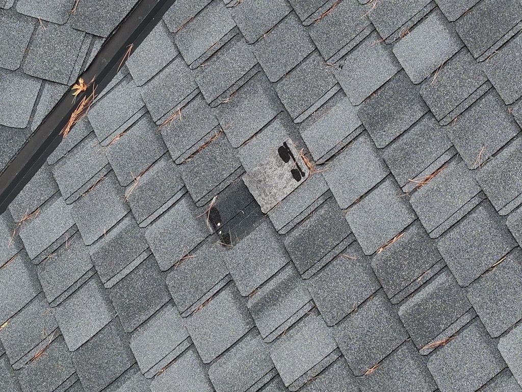
Tree impact & roof documentation
From tree impact to an organized property record.
After a tree struck a home, the property needed a record that connected the impact area with the surrounding roof and exterior conditions.
See the case study ↗
Fieldwork & community
Hunting-tract maps. Roof and thermal reports. Construction photographs. And community stories—from local searches to the ESSĒ fire.
Inspection work in practice
Two report-based examples show what an assignment produces and how the finished documentation supports the next conversation.
Tree impact & roof documentation
After a tree struck a home, the property needed a record that connected the impact area with the surrounding roof and exterior conditions.
See the case study ↗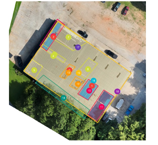
Commercial roof · visual & thermal inspection
A commercial metal roof had prior sealant work, tarped areas, skylights, and concerns that needed a closer look. A daytime aerial inspection and an after-sunset thermal scan brought those observations into one report.
See the case study ↗Reynolds Landing · Lake Oconee
Aerial footage from October 10–11, 2026, documenting a difficult moment for the Lake Oconee community. With appreciation for the first responders and everyone who helped.

October 10, 2026 · Fire footage
Aerial footage showing the fire and its surrounding setting at Lake Oconee.

October 11, 2026 · The aftermath
Aerial documentation of the damage following the fire. With appreciation for the first responders and everyone who helped.
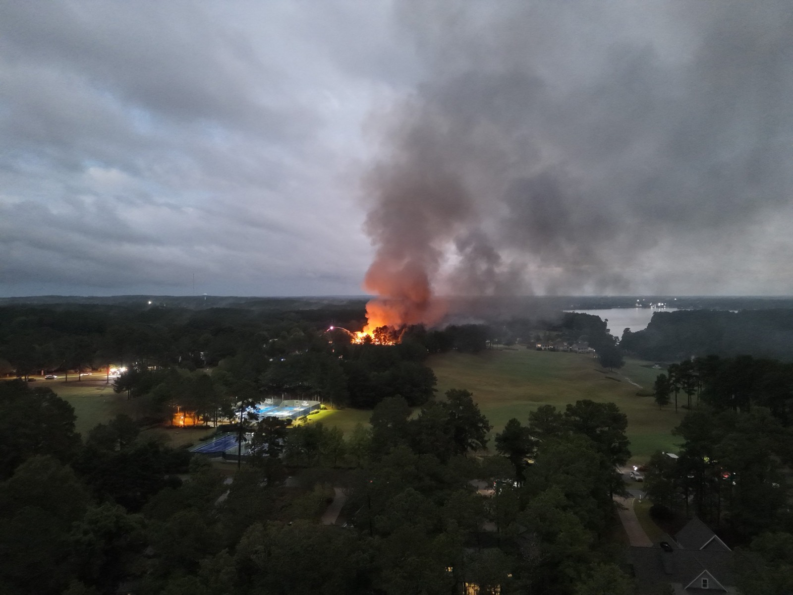
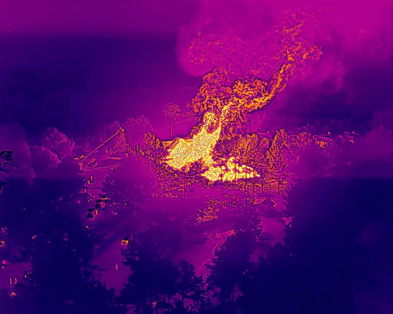
These videos document a community event. They are not presented as a commissioned inspection or official fire investigation.
Community search support
In July 2025, Spyglass shared a request for sightings while helping search near Cuscowilla on Lake Oconee. The next morning, the page reported that she was home safe and thanked everyone who shared the post.
Local search appeals and updates for Graycie and Mel are also part of our community story. Aerial search support works alongside local efforts and depends on availability and conditions.
Hunting & recreational tracts
The 7 Mile example connects a full-tract aerial view with numbered locations and a close-up—useful for planning food plots, discussing access, and keeping everyone working from the same reference.
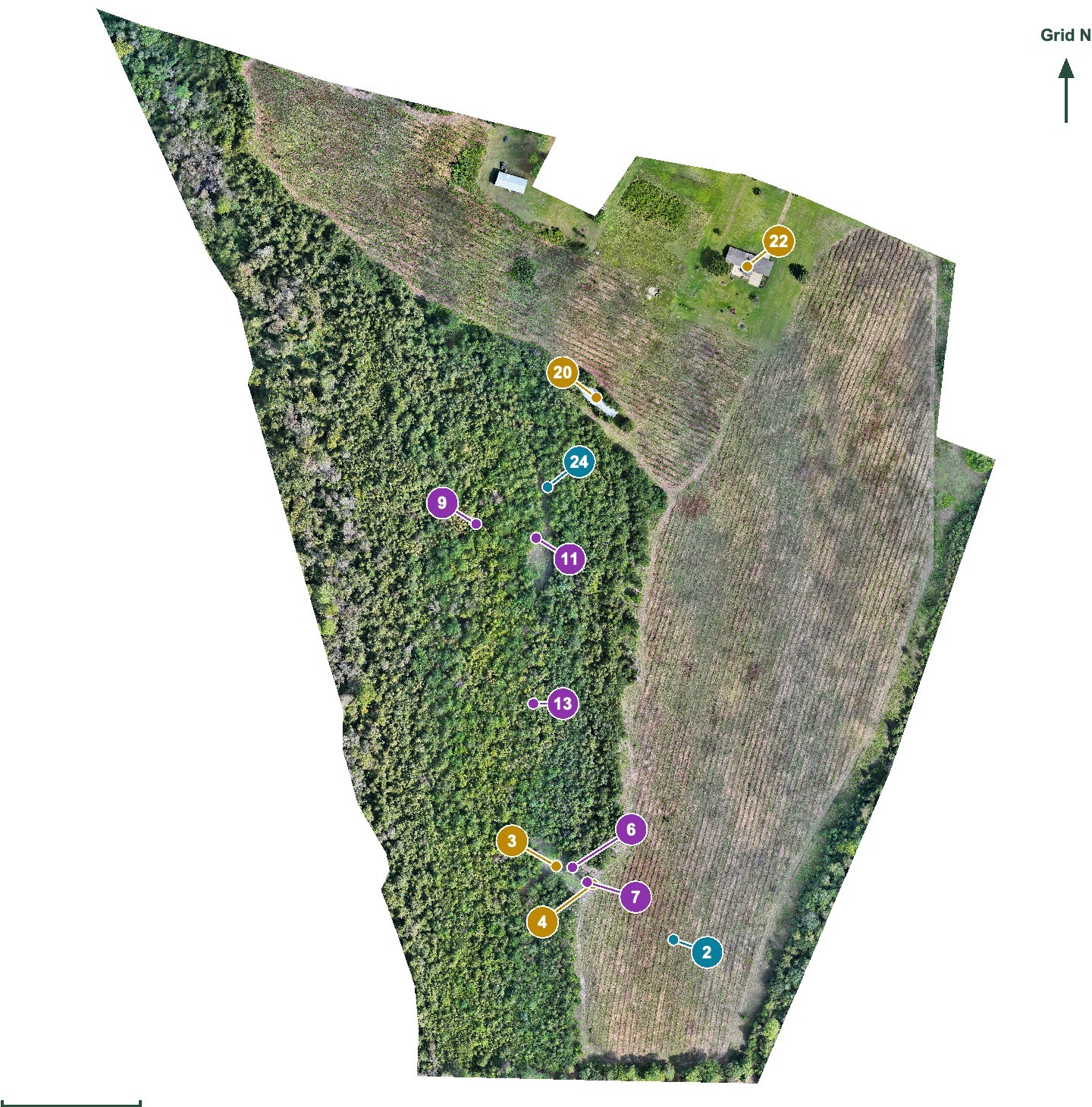
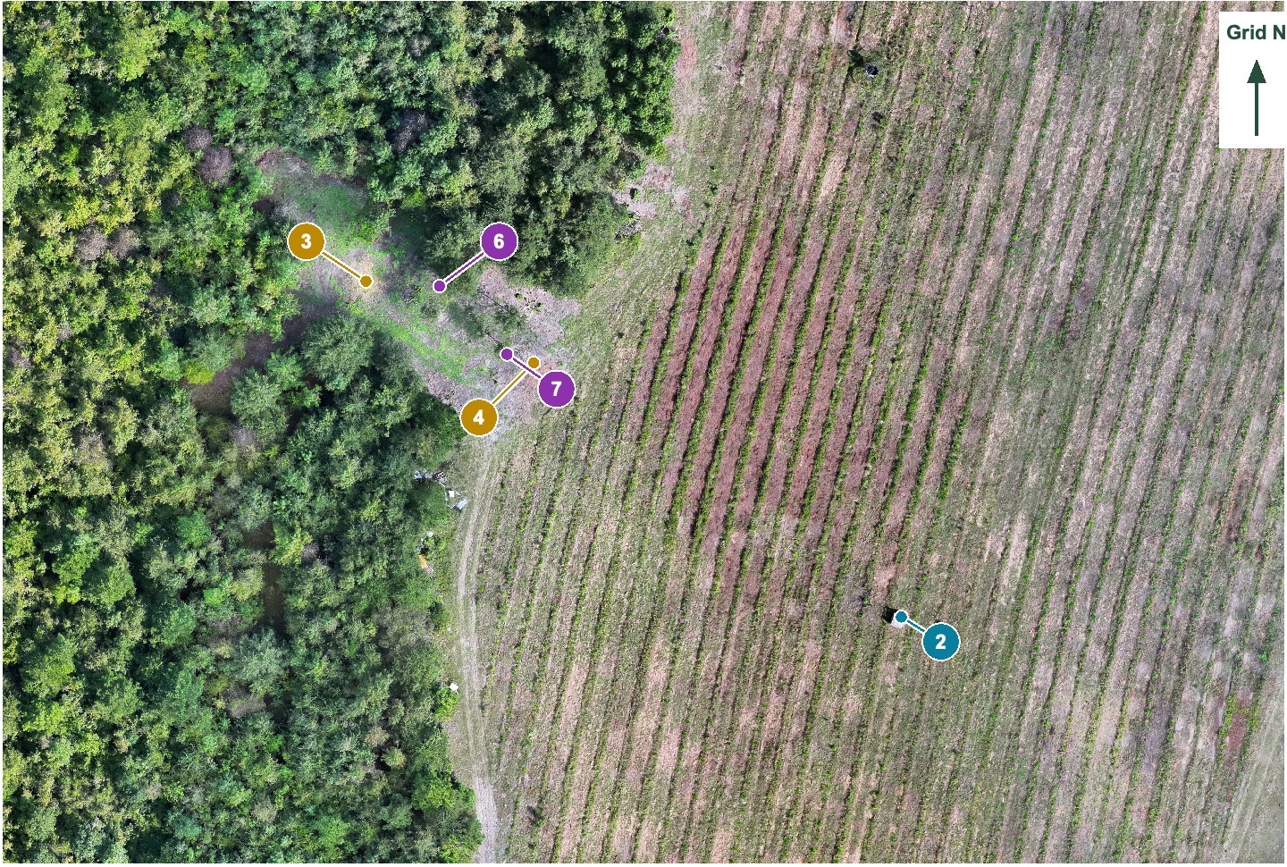
Aerial imagery and recorded reference points. Confirm access and conditions on the ground. This planning map does not establish legal boundaries or reveal every feature beneath trees.
Explore hunting & tract mapping ↗Roof & property documentation
Overview images connect the site. Close details show the condition. Marked locations and written observations make the record easier to use.
Inspection detail
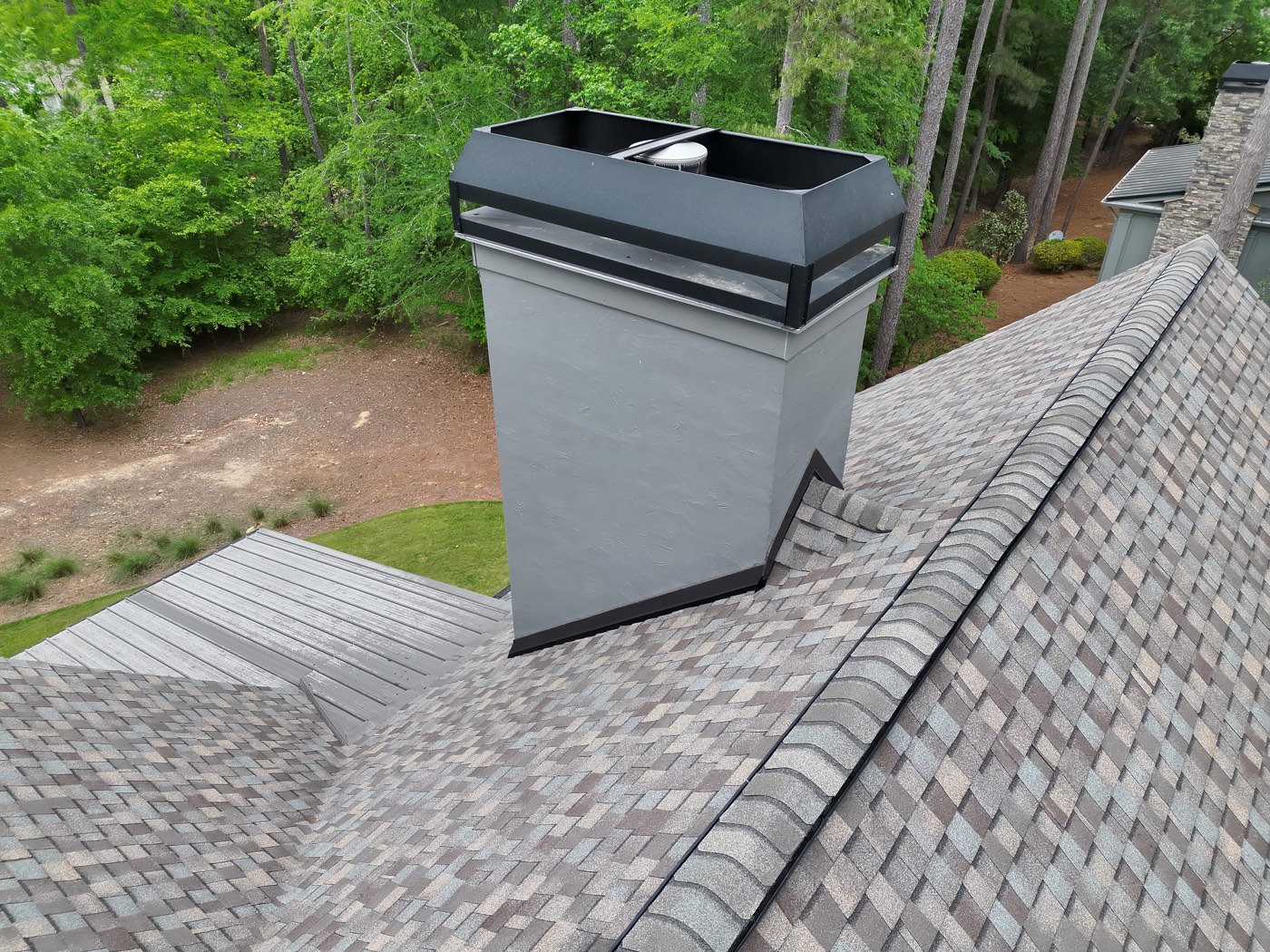
Overview and close-detail photographs, marked observations, and location references organized into a report.
About aerial inspections ↗Shopping-center roof example
A roof overview, selected measurements and thermal images for follow-up with the appropriate contractor.
About thermal roof imaging ↗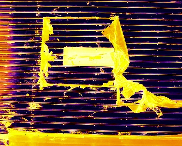
Construction progress photography
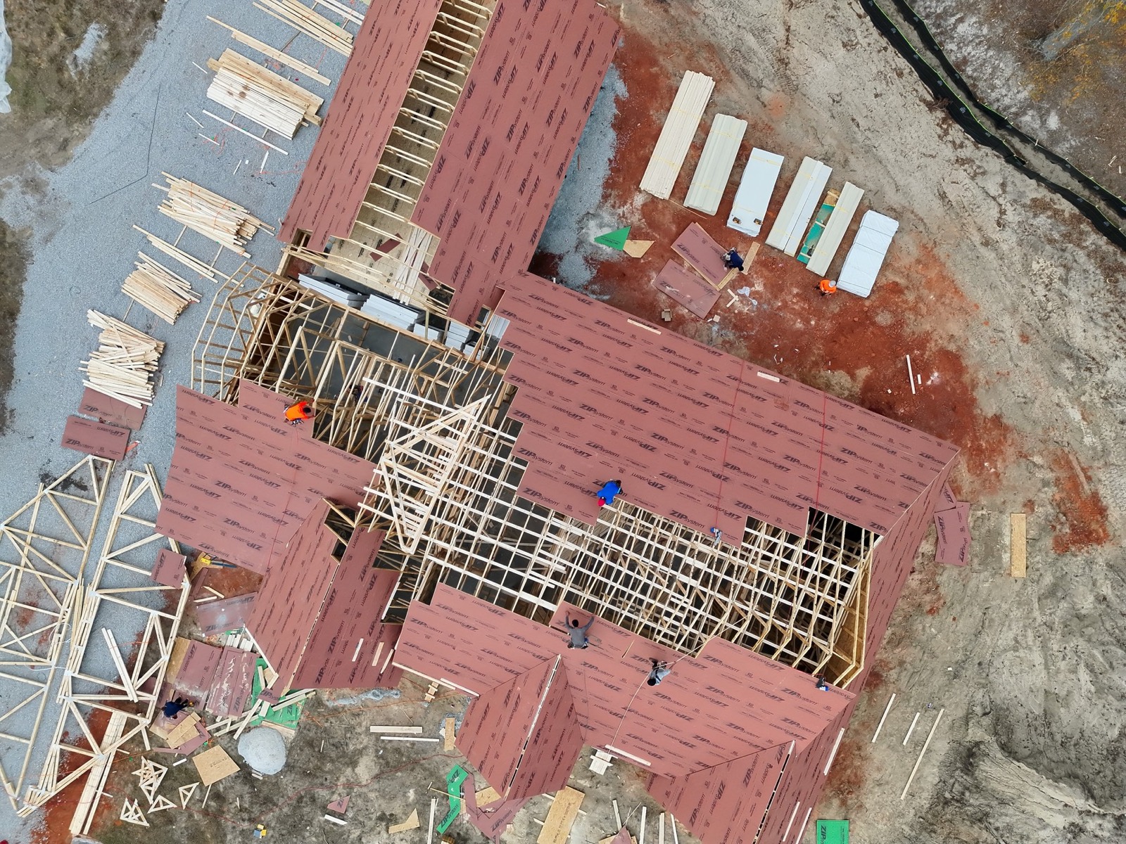
Aerial photographs taken across several weeks show the changing site and construction milestones. Agree on viewpoints and timing for a practical record owners and builders can share.


Send the property location, your concern or project goal, and your preferred timing. We’ll confirm scope, deliverables, price, and scheduling before booking.